Leonida Airspace Sector 04 // Naval Coordinate Grid

Master the Air corridors and Coastal Waters of Leonida

A precision logistical directory for fixed-wing pilots, rotorcraft captains, and offshore skippers navigating the coastal channels, salt flats, and urban towers of Vice City and beyond.

Launch Flight Protocol Inspect Vessel Telemetry

Hangar Index

Verified terminal bays, private secure hangars, and grass airstrips mapped across state sectors.

Commercial tarmac apron at major municipal airport during late afternoon Primary Terminal

Escobar South Cargo Apron

Direct runway access via Taxiway Bravo. Reinforced concrete pads capable of servicing widebody freight lifters and executive corporate jets. Secured with 24-hour perimeter clearance.

Capacity6 Heavy Bays
Strip Length3,400 ft
Fuel TypeJet-A1 Piped
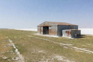
Corrugated steel hangar at an isolated grass runway Grass Roots

Grass Rivers Remote Shed

Uncontrolled coastal strip nestled between marsh inlets. Hand-cranked fuel pumps with direct canal access for amphibious hulls.

Runway1,100 ft Turf
AvGas100LL Drum
AccessUncontrolled
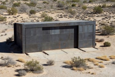
Secure steel reinforcement hangar doors in desert scrub Restricted

Port Gellhorn Coastal Depot

Reinforced municipal maintenance shelters adapted for heavy utility helicopters and search-and-rescue marine patrol crafts.

HelipadTriple Tier
Crane Rig12-Ton Gantry
SecurityClass 3 Badge
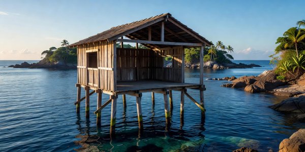
Wooden open hangar built on wooden stilts over blue water Amphibious

Keys archipelago Marine Slip & Lift

Dual-purpose covered slipway allowing rapid dry-dock hoist for performance catamarans or tethering for twin-pontoon bushplanes.

Draft Depth18 ft Mean
Tide Swell±2.4 ft
Mooring4 Stern Lines

Coastal Patrol Routes

Telemetry, radar corridors, and navigation milestones along the shoreline barrier reefs.

Waypoint Identifier Sector Coordinates Permitted Ceiling Typical Sea State Advisory Note
CORAL-BRAVO-1 25°44'12"N, 80°09'30"W 1,200 ft MSL Chop (2-3 ft) Low-altitude tourist helicopters active along hotel beachfront.
SHOAL-RUNNER-9 24°55'02"N, 80°35'44"W 500 ft MSL Moderate Swell (4-6 ft) Uncharted limestone heads shallow to 3 ft at low tide. Maintain watch.
SWAMP-PERIMETER 25°28'50"N, 80°48'11"W 2,500 ft MSL Flat Water (Canal) Airboat crossings perpendicular to primary river flow. Sound horn.
GELLHORN-GULF-EXT 26°10'14"N, 81°49'22"W Unrestricted Heavy Offshore Roll Deep-draft commercial container shipping lane. Give 500m berth.

Seaplane and Chopper Specs

Operational envelopes for mixed-terrain Leonida maneuvers.

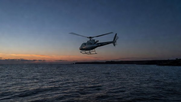
Twin engine helicopter hovering above darkening coastal waters Rotorcraft

Supervolito Carbon Utility

Designed for rapid executive transfers between oceanfront skyscraper helipads and mega-yacht aft decks. High yaw authority under gusty windward sea conditions.

Top Airspeed162 Knots
Hover Ceiling8,500 ft
Payload2,850 lbs
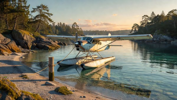
Floatplane anchored at water edge in coastal lagoon Amphibious

Mammoth Dodo Classic

Rugged radial engine twin-float high-wing aircraft. Exceptional low-stall characteristics make it ideal for touch-and-go water landings in protected inlets.

Cruise Knots118 Knots
Water Takeoff920 ft Roll
Hull ResistanceGrade 4 Salt

Open Water Navigation

Essential maritime protocols for piloting deep-vee hulls through Leonida's treacherous sandbars.

Sandbar Drift Warnings

The channels surrounding Starfish Island shift following seasonal gales. Never rely on paper soundings older than thirty days. Always read surface ripples to anticipate submerged flats.

Night Marker Lights

Port-side beacons flash quick-flashing red; starboard beacons maintain steady green. Unlit wooden fishing stakes are frequent hazards inside the Grass Rivers waterways.

Tidal Bore Warnings

The tidal sweep under the Overseas Highway bridges generates localized currents up to 6.5 knots during spring ebbs. Maintain steerage speed when transiting narrow spans.

Flight Checklist & Runway Calculator

Verify wingspan parameters against Leonida airfield lengths before logging outbound throttle.

Select an airframe and runway to run the dispatch clearance calculation.